.jpg)
Current readings
Read .
Surf, south-facing shores
3 to 5 feet
Forecast issued 902 AM HST Thu Oct 15 2026
National Weather Service surf zone forecast, read Applies to Oct 15, 2026, 9:02 AM HSTSouth-facing shores of Maui, the aspect Mākena faces.
Tides at the Makena station
- High 6:46 AM, 1.6 ft
- Low 1:22 PM, 0.7 ft
- High 3:41 PM, 1.0 ft
- Low 11:07 PM, 0.1 ft
- High 7:54 AM, 1.5 ft
- Low 11:34 PM, 0.2 ft
NOAA tide predictions, station 1615202 Makena, read Astronomical predictions, not observations.
Water quality
No open advisory covering this coast.
Hawaiʻi Department of Health, Clean Water Branch, read Island-wide brown water advisories are what usually reach this coast.
From the forecaster's discussion, quoted in full
The current small bump in the northwest swell will fade tonight before a moderate north-northwest swell arrives Friday and continues through the weekend. Surf along north and west-facing shores should top out around seasonal average or slightly higher during the peak of the swell Friday afternoon and Saturday, then slowly decline late Saturday and Sunday as the dropping swell shifts more northerly and a smaller overlapping northwest swell arrives. Both swells will fade early next week.
National Weather Service surf zone forecast, read Applies to Oct 15, 2026, 9:02 AM HSTSouth-facing shores of Maui, the aspect Mākena faces.
Could not read: PacIOOS wave model.
Permanent hazard, not a forecast
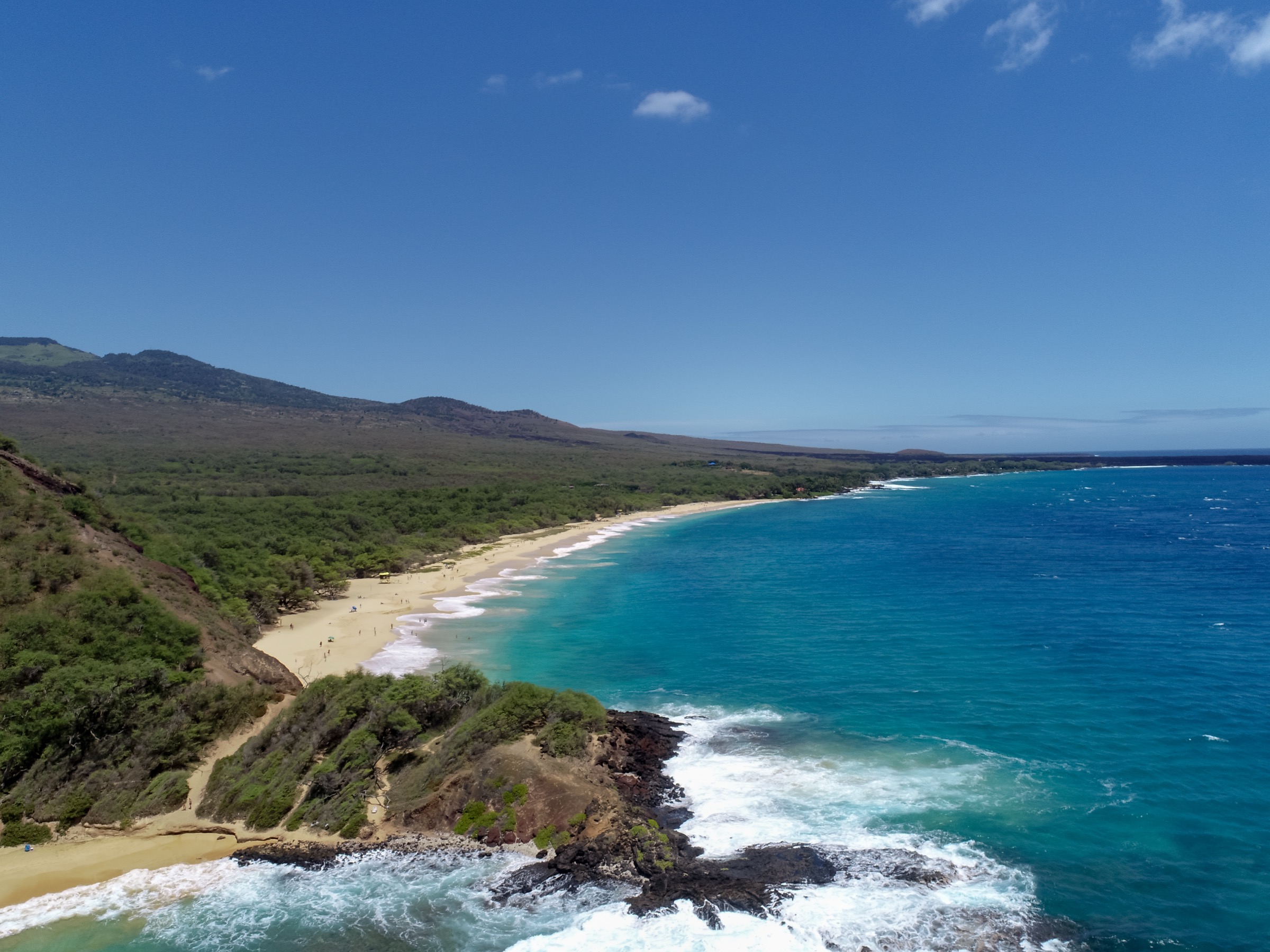
The shore break is the hazard here, and wave height does not measure it
The shore break at Big Beach can be very dangerous.
Waves at Big Beach break directly onto a steep sand face in very shallow water. That is what makes the shore break dangerous, and it is a property of the beach rather than of the surf on a given morning.
Wave height does not indicate shore-break safety. A calm-looking morning and a low surf forecast are not an all-clear for waves breaking directly onto the sand.
So watch how the water is breaking rather than how high it is. If waves are collapsing onto the sand instead of rolling in, that is the pattern, and it injures strong swimmers.
The Maui News, checked
Why the south-facing number is the one that matters
The National Weather Service in Honolulu issues a surf zone forecast about three times a day that breaks Maui surf out by shore aspect: north facing, west facing, south facing and east facing. Mākena faces roughly south-southwest, so the south-facing row is the one that applies, and it can differ from the north-shore number by several feet.
That seasonal pattern is the opposite of the one visitors usually expect. South Maui gets its swell in the northern-hemisphere summer, from storms in the Southern Ocean, and sits sheltered through the winter when the north shore is getting the big surf.
High Surf Advisories for south-facing shores in Hawaiʻi are issued at a 10-foot face-height threshold, which is high. Most days there's no advisory, so treat its absence as normal rather than as reassurance.
The wave model, and the buoy that doesn't help
PacIOOS at the University of Hawaiʻi runs a nearshore wave model for Maui on roughly a 500-metre grid, which is fine enough to resolve how Kahoʻolawe and Molokini shadow south swell before it reaches this coast. That shadowing is the local physics here, and it's the reason island-scale forecasts can be wrong at Mākena specifically.
There is no useful wave buoy for this coast, and it's worth knowing why. The nearest one is off Pāʻia on the north shore, about 27 miles away, reading northeast trade swell on the other side of Haleakalā. Its numbers have nothing to do with Mākena. The buoy that would have been relevant, off southwest Lānaʻi, isn't reporting.
Use the tide station actually called Makena
NOAA has a tide station named Makena, number 1615202, about 1.5 miles up the coast from Big Beach. Almost everything online quotes Kahului instead, which is 18 miles away on the opposite side of the island and runs a noticeably larger tide range with different timing.
For a beach where waves break on a steep sand face, the tide stage is a real input, so the difference is worth caring about. County of Maui's own lifeguard-partnered beach data uses 1615202 for Mākena, which is a reasonable endorsement.
What no forecast can tell you
There is no shore-break product for Big Beach, or for any Hawaiʻi beach, and none of the data above can be turned into one. Shore break depends on the shape of the sand at the waterline, which no model carries.
This is why you won't find a green light on this page. Big Beach recorded 33 spinal injuries between 2009 and 2017, the most of any beach in Hawaiʻi, and those did not all happen on the days that looked dangerous. A low number here is not permission.
Questions people ask
What is the surf like at Mākena today?
The readings on this page come from the National Weather Service surf zone forecast for Maui's south-facing shores and the PacIOOS nearshore wave model, each timestamped with when we read it.
When is the surf biggest at Mākena?
In the northern-hemisphere summer. South Maui faces south, so it receives southern-hemisphere swell from about April to October and is sheltered from the winter north swell.
Which tide station should I use for Mākena?
NOAA station 1615202, named Makena, about 1.5 miles from Big Beach. Kahului, station 1615680, is 18 miles away on the opposite coast and has a larger range with different timing.
Is there a surf buoy near Mākena?
No useful one. The nearest reporting buoy is on the north shore near Pāʻia, reading northeast trade swell blocked from this coast by Haleakalā.
Does a small surf forecast mean the shore break is safe?
No. There is no shore-break forecast for this beach, and a low surf reading is not an all-clear for it. Watch how waves break at the waterline before deciding.
Sources for this page
- NOAA National Weather Service, Honolulu Forecast Office
- Pacific Islands Ocean Observing System, University of Hawaiʻi: SWAN Maui nearshore wave forecast
- NOAA CO-OPS tide predictions, station 1615202 Makena
- Hawaiʻi DLNR, Division of State Parks: Mākena State Park
This site is independent of Hawaiʻi DLNR, the County of Maui and emergency services.