.jpg)
Facts at a glance
Sources and review dates- Keawalaʻi Church founded
- 1832, originally as the Church of Honuaʻula. Congregational, affiliated with the United Church of Christ.
- Mākena Landing's trade
- Cattle from ʻUlupalakua Ranch, about 1,000 head a year to Honolulu. One of Maui's busiest ports by the 1920s.
- Puʻu Olaʻi
- A cinder cone of the Hāna Volcanics, mapped by USGS at 13,000 to 30,000 years old.
- The Kalua o Lapa lava flow
- A.D. 1420 to 1620 per USGS radiocarbon and paleomagnetic dating, not 1790.
A port, not a resort
Captain James Makee was a Massachusetts whaler who settled in Hawaiʻi in 1843 and acquired the ʻUlupalakua estate by 1858, turning it into Rose Ranch and later ʻUlupalakua Ranch. It became the largest ranch on Maui, running more than 5,000 head of cattle and sending about a thousand a year to market in Honolulu through the landing at Mākena.
By the 1920s Mākena Bay was one of the busiest ports on Maui, with interisland steamers calling and over a hundred families living in the area. Then Kahului Harbour was improved, traffic moved north, and the population fell away. The military dismantled the landing's pier during the Second World War and homes near it were razed.
Worth a correction while we're here: Mākena is often described as a whaling port. We found no source supporting that. Makee was a whaler who became a rancher, and what shipped through Mākena was cattle.
Keawalaʻi, 1832
Keawalaʻi Congregational Church sits at 5300 Mākena Road, and its own history dates its founding to 1832, when it was the Church of Honuaʻula. The first building was pili grass; it was later rebuilt in stone and wood. It's affiliated with the United Church of Christ and still holds Sunday services.
For anyone navigating this coast, the church is also the most useful landmark on Mākena Road. The public beach right-of-way lot for Maluaka Beach sits directly opposite it.
The lava is much older than the guidebooks say
Drive south past the end of the beaches and the road runs out into black rock. That's the Kalua o Lapa flow, East Maui's youngest lava, which erupted from Haleakalā's lower southwest rift zone and formed Cape Kīnaʻu and the eastern edge of La Perouse Bay.
You will read almost everywhere that it erupted in 1790. USGS dates it to between A.D. 1420 and 1620. The old date came from mid-twentieth-century work that leaned partly on comparing early European expedition charts. Paleomagnetic measurements didn't match flows of that era, and charcoal recovered from beneath the flow and beneath spatter at the vent returned radiocarbon ages calibrating to roughly A.D. 1400 to 1640.
USGS is unusually candid that this isn't fully settled, and the reason is worth repeating. Hawaiians questioned in 1841 said their grandparents had seen the flow, which points to something closer to 1750. USGS's own write-up says the effort to resolve the discrepancy is unfinished, and that oral history is important and not to be overlooked among the numbers from laboratories. We'd rather leave both on the page than flatten it.
Puʻu Olaʻi
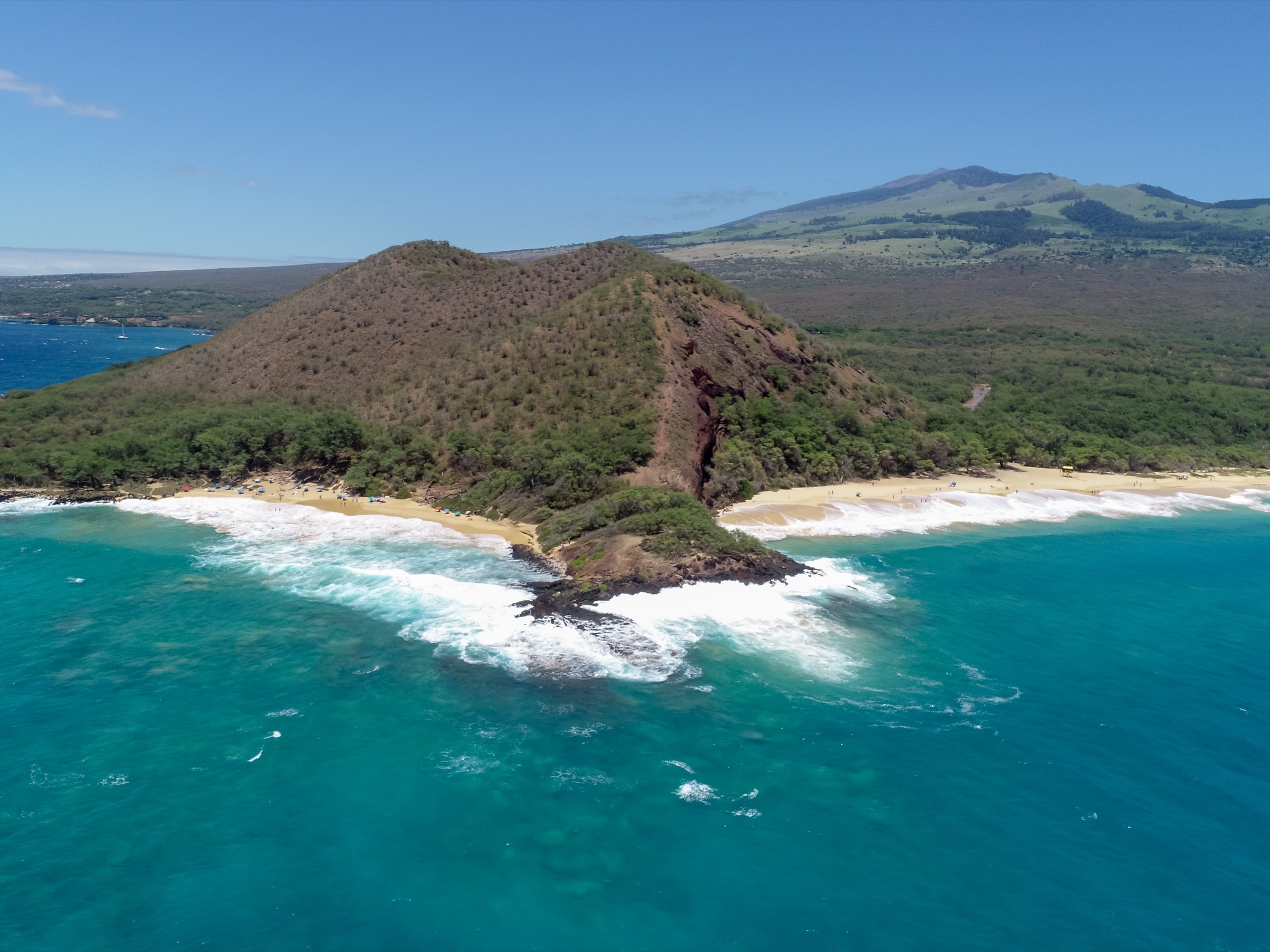
The cone between Big Beach and Oneʻuli is the reason this stretch of coast looks the way it does. USGS maps Puʻu Olaʻi as a cinder and spatter cone of the Hāna Volcanics, dated between 13,000 and 30,000 years old.
Its erosion is where Oneʻuli's dark sand comes from, and it's why Little Beach sits hidden on the far side. You'll see a height of 360 feet quoted for it in a lot of places. We couldn't find that figure in any USGS or federal record, so we're leaving it out.
Questions people ask
How old is Keawalaʻi Church?
It was founded in 1832 as the Church of Honuaʻula. The first building was pili grass, later rebuilt in stone and wood. It's a United Church of Christ congregation at 5300 Mākena Road.
Was Mākena a whaling port?
No source we found supports that. Mākena Landing shipped cattle from ʻUlupalakua Ranch. Captain James Makee, who built that ranch, was a former whaler, which may be where the confusion comes from.
When did the La Perouse lava flow erupt?
USGS dates the Kalua o Lapa flow to between A.D. 1420 and 1620, based on radiocarbon and paleomagnetic evidence. The widely repeated 1790 date comes from older work and conflicts with the current dating, though Hawaiian oral history recorded in 1841 points to a more recent eruption.
What is Puʻu Olaʻi?
A cinder cone between Big Beach and Oneʻuli Beach, mapped by USGS as part of the Hāna Volcanics and dated to between 13,000 and 30,000 years old.
Sources for this page
- U.S. Geological Survey: geology and history of Haleakalā
- USGS Volcano Watch: youngest lava flows on East Maui probably older than A.D. 1790
- USGS Open-File Report 2007-1089: geologic map of the State of Hawaiʻi
- Keawalaʻi Congregational Church: church history
- Mākena: A Cultural-Historical Genealogy of Place (Kīpaipai Maui)
This site is independent of Hawaiʻi DLNR, the County of Maui and emergency services.